Original paper
Electrical Resistivity imaging of spilled crude at the Obuguru inter- tidal flat, Forcados area, Delta State, Nigeria
Abstract
Electrical Resistivity imaging was conducted in a crude oil spill site at Obuguru in the Forcados estuary area of the western Niger Delta with the aim of investigating the lateral and vertical spread of the hydrocarbon. Five survey profiles were laid in the study area with three of them within the polluted area to map the contaminated zone. The 2D resistivity imaging technique using the dipole- dipole array method was adopted for the survey with...
Figures & Tables
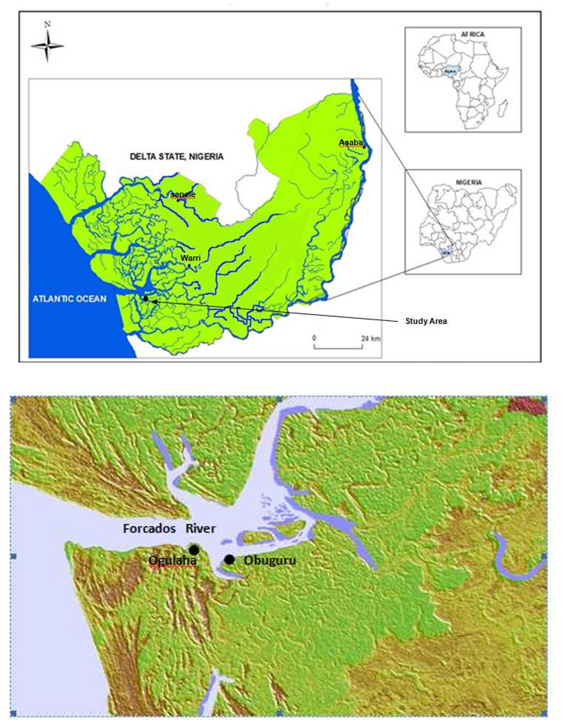
Fig. 1. Satellite image of Forcados area showing Obuguru
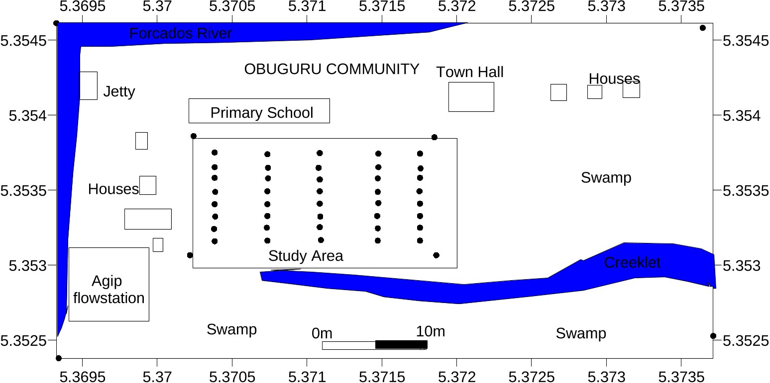
Figure 2b: Layout of 2D Dipole-Dipole and VES data acquisition of Obuguru area
Figure 2a: Obuguru community showing the polluted site
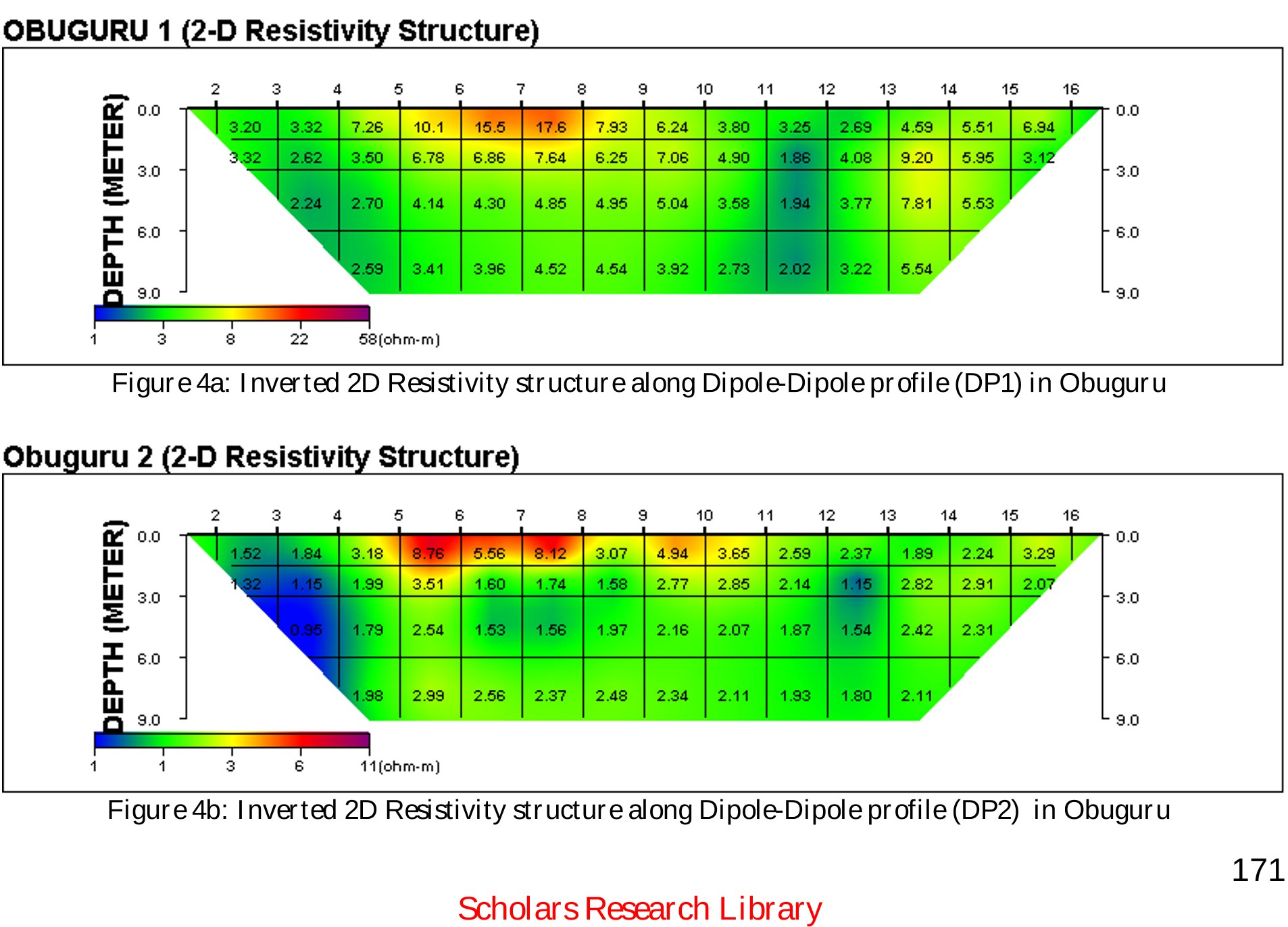
Figure 3: Hydrocarbon spill site in Obuguru community
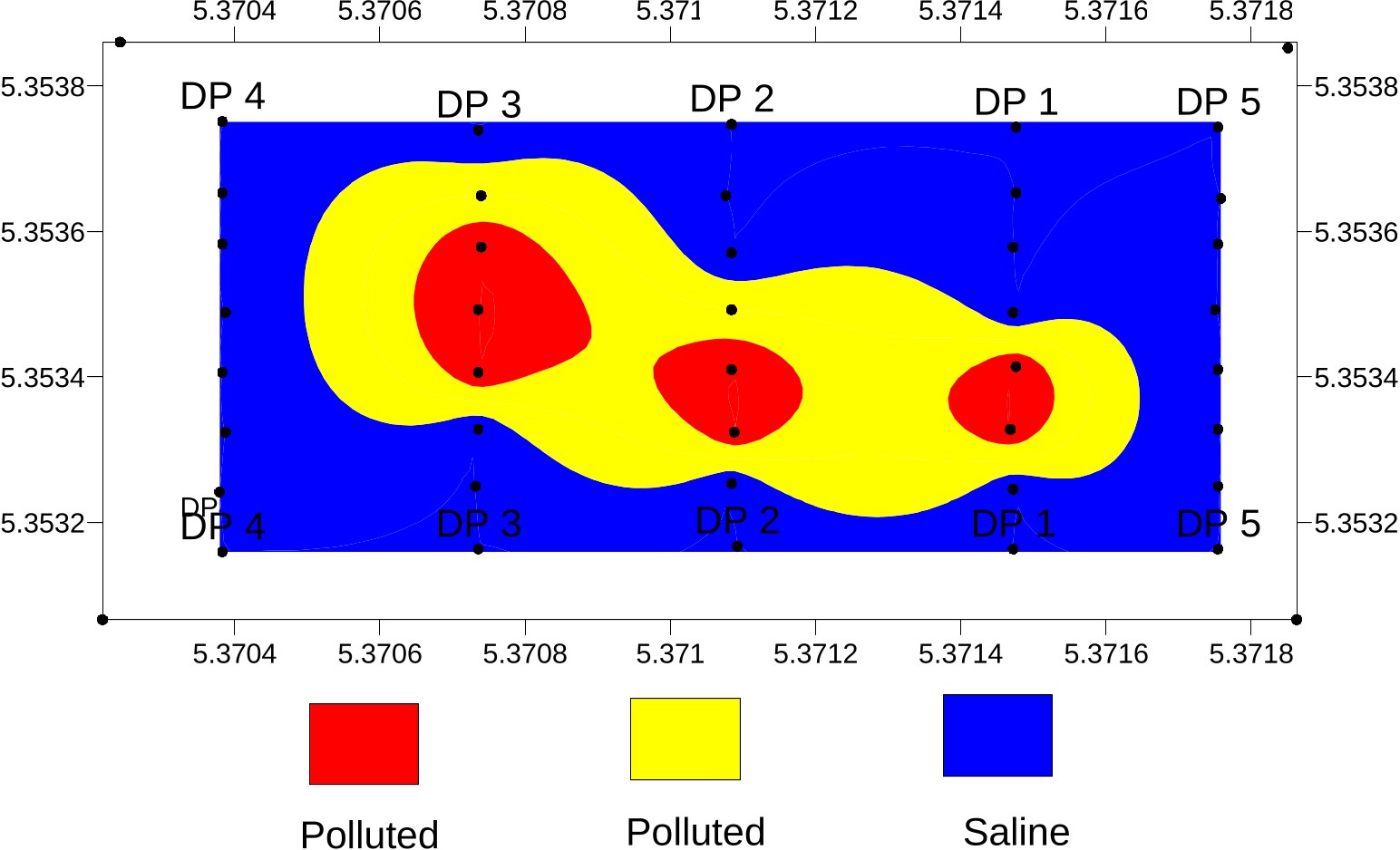
Figure 5: Hydrocarbon polluted area
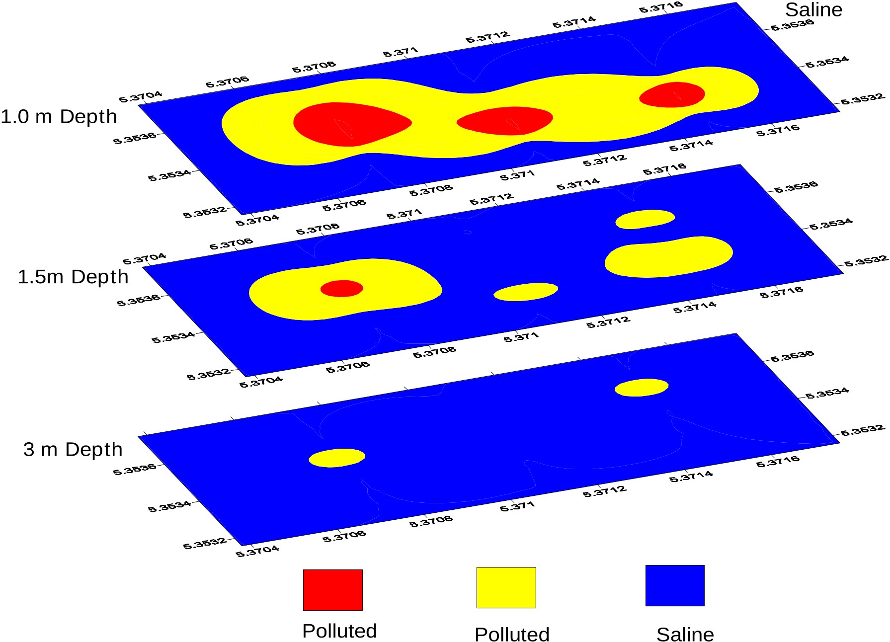
Figure 6: 3D depth slices of Botobou at depths 1, 1.5 and 3 m
Paper Details
Title
Electrical Resistivity imaging of spilled crude at the Obuguru inter- tidal flat, Forcados area, Delta State, Nigeria
Published Date
Jan 1, 2011
Journal
Volume
2
Issue
4
Pages
166 - 175
References